Concept Maps for UMCH: UPDATED 11.18.25
| PCPW Co-chairs | City Council, Documents, Land Use, Uncategorized
UPDATED 11.18.25:
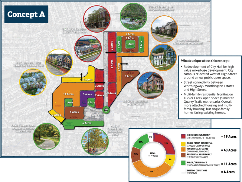
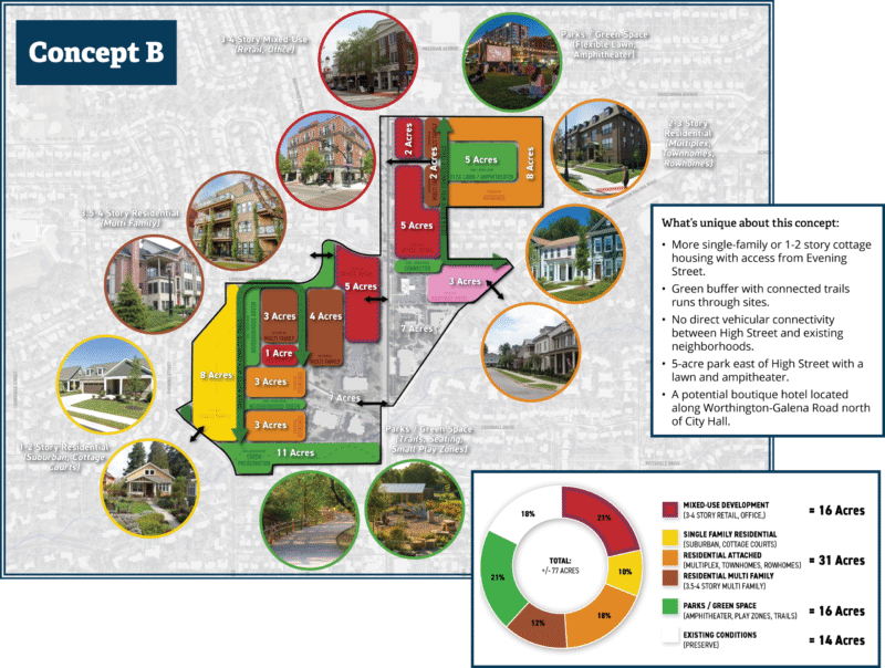
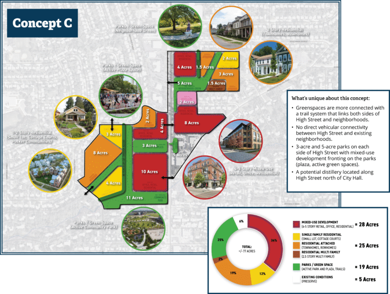
Here are updated versions of the three “Concept Maps” presented at the 11/12/25 event, and which are also in the online survey. Clicking them will lead you to the survey on the Worthington Together website.
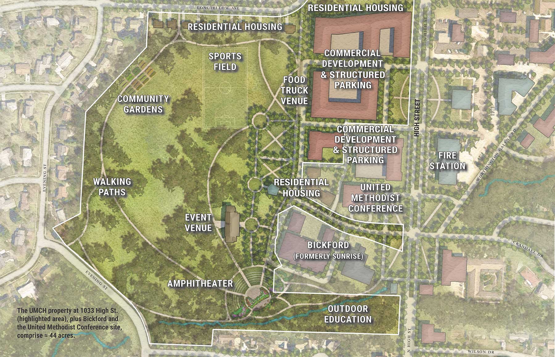
Here is the map we (Project Community Park Worthington, Worthington Alliance for Responsible Development, and Councilman David Robinson) had asked to have included, along with the others, at the 11/12/25 meeting:
ORIGINAL POST (Concept A, B, and C maps are from early November 2025 and have been updated to the above maps):
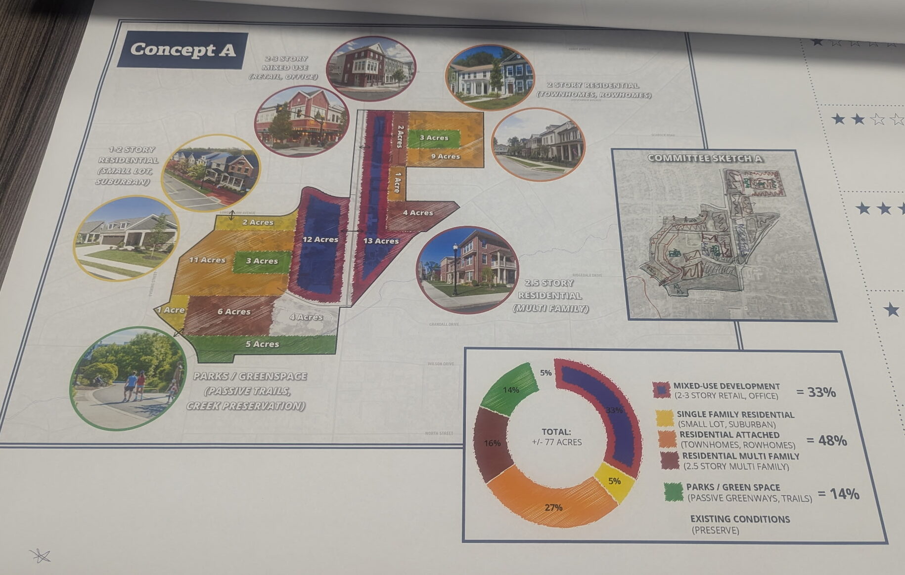
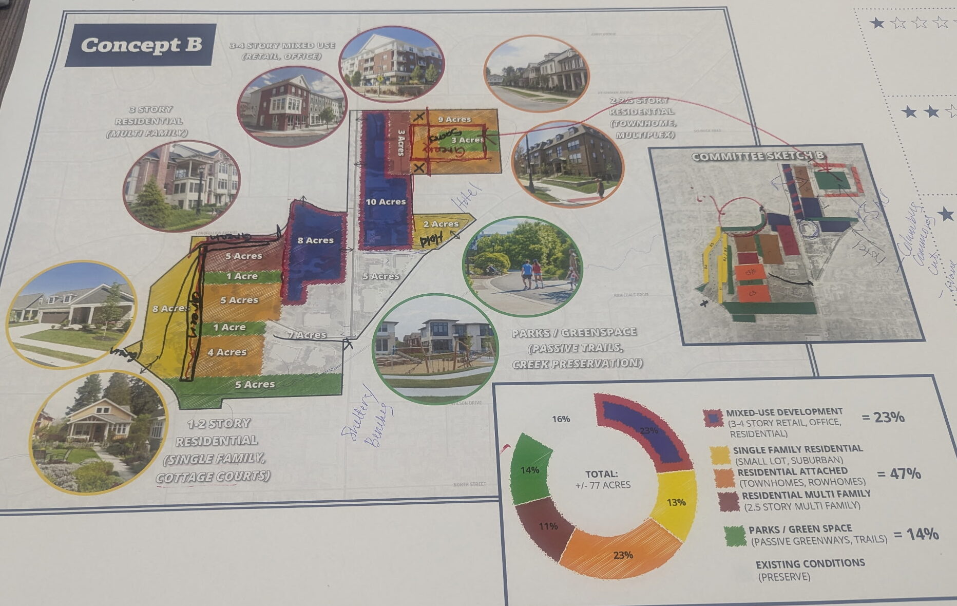
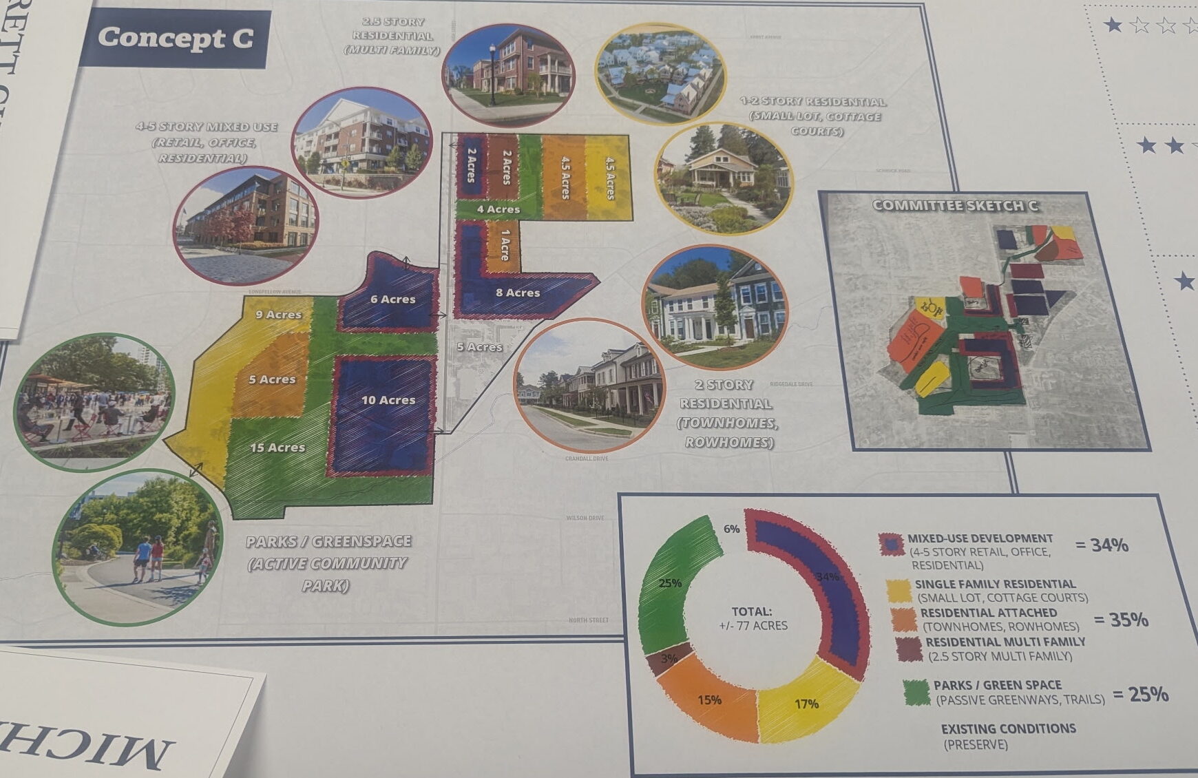
Below, the existing drafts for the three Concepts for the UMCH area, created by Planning Next for the Comprehensive Plan update committee. These, or something like these, will be presented at the Wednesday, Nov. 12, 2025 public meeting. Please note that the 5 acres of green at the south end of the UMCH property is the Tucker Creek area. This is not developable and while a natural area, should not be considered usable park land in the usual sense. More info here.
Here is the map we (Project Community Park Worthington, Worthington Alliance for Responsible Development, and Councilman David Robinson) have asked to have included, along with the others, at Wednesday’s meeting:
Which map is your favorite?
Let us know by sending an email to info@projectcommunityparkworthington.com, or by signing our petition and sharing your thoughts in the comment field here:
https://projectcommunityparkworthington.com/sign-the-petition/
And please join us at the event Wednesday! We need as many members of the community present as possible.
WHAT: Community Choices (Round 2 of Public Input)
WHEN: Wednesday, November 12, 2025, 6:30-8:00 PM
WHERE: Worthingway Middle School, 6625 Guyer St.
RSVP: Registration encouraged but not required. Register here: https://worthingtontogether.org/get-involved/#Round2